Map description
Secunda etas Mundi
[Second Age of the World]
By Hartmann Schedel (1449 - 1515)
Published by Sebald Schreyer (1446-1520) and Sebastian Kammermaister (1446-1503), Nuremberg 1493.
Text in Latin
Note: No original title but the double leaf is headed
This 1493 map from the Chronicle of the World by the Nuremberg physician Hartmann Schedel (1449-1515) is an example of a transitional model of cartography including both medieval and renaissance features.
 six-armed man
The Chronicle, a compilation of sacred and profane history published simultaneously in Latin and German, was commissioned by members of the thriving local business community, at a time when Nuremberg was the richest city in Germany, building its fortune on commerce with the East through contacts with Venice and Lisbon. The book was a huge commercial success, thanks in good part to its lavish illustrations, with more than a thousand woodcuts by Nuremberg artists, possibly including young Albrecht Duerer, soon to become the greatest German painter and engraver of his times. It included two maps, one of Northern Europe and this world map.
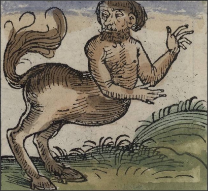
The world map, located at page 12a of the book, follows a list of monstrous creatures started on the previous page, some of which are given on the left side of our sheet. This catalogue of human freaks, including a six-armed man and a centaur, combines elements from the Classical tradition (from the “Natural History” of Pliny) and the Mediaeval tradition (from the popular collection of “Marvels from the East”).
 centaur
 blowing heads
The three sons of Noah, Sem (Shem), Cam (Ham), and Japhet (Japheth), stand at three corners of the map; in the fourth corner a Latin inscription gives the names of the winds, represented in classical style as blowing heads, a visual feature common to works of the recently revived Ptolemaic cartographic tradition, in contrast to the previously used compass roses showing wind directions.
The Latin text at the bottom explains the Ptolemaic division of the world into three parts, Asia, Africa and Europe, and connects them to the sons of Noah.
The layout and content of the map reflect traditional Ptolemaic cartography. There is no Scandinavia in the North, Africa is shown as a mass of continuous land at the south encircling the Indian Ocean, Sri Lanka is portrayed many times larger than in reality and China drawn very sketchily and referred to in the classical mode as as “Serica” (the land of Silk), instead of as “Cathay” (as in Marco Polo) or as “China” or “Sina”, as will be usual since the sixteenth century. By adopting the Ptolemaic model, in fact, early printed maps like this willfully ignored the richer information about Inner Asia and China displayed in the contemporary manuscript maps or globes, to focus on the textually prestigious but limited knowledge of the Ancients.
The only element reflecting the recent geographical discoveries is the hint of the Gulf of Guinea in the representation of Eastern Africa, taking account of Portuguese knowledge around 1470.
Sources
- http://www.beloit.edu/nuremberg (with very rich info and full translation of the Nuremberg Chronicle)
- http://www.cartographic-images.net/Cartographic_Images/260_Schedel.html
- http://www.mapforum.com/06/schedel.htm
- Pauline Moffitt Watts, “The European Religious Worldview and its Influence on Mapping,” in David Woodward (ed.), The History of Cartography. Volume 3: Cartography in the European Renaissance, Chicago 2007, 382-400
- Shirley, Rodney W. The Mapping of the World: Early Printed World Maps 1472-1700. Riverside, CT: Early World Press Ltd., 2001, 19.
- Cambell, Tony. The Earliest Printed Maps 1472-1500, London: The British Library, 1987, map 220, and notes on page 153.
- Karrow, Robert W. Jr. Mapmakers of the Sixteenth Century and their Maps, Chicago, Speculum Orbis Press, 1993
- Nordenskiöld, Adolf Erik, Facsimile-atlas to the early history of cartography: with reproductions of the most important maps printed in the XV and XVI centuries, New York : Dover, 1973, 38-40.
- CITCO Calendar 2003: cover.


