Map description
Chinae, olim sinarum regionis, nova descriptio
[A new map of China, once called the region of the Sinae]
By Abraham Ortelius (1527 - 1598)
Published by Christopher Plantin, Antwerp, 1592 (first published by the same publisher in 1584)
Text in Latin
This map is numbered map 164 in Ortelius’ Theatrum, and as shown in the cartouche in the lower left, it reproduces a map by Luiz Jorge de Barbuda (designated by his Latin name Ludovicus Georgius) (fl. 1575-1599). The information on China was kept as a state secret by the Portuguese government, but after Portugal came under the control of Spain in 1580, Barbuda was nominated cosmographer and mapmaker of the Spanish Academy of Mathematics and made a manuscript map of China which reached Ortelius in 1580 via his friend, the biblical scholar and orientalist Arias Montanus (1527–1598).
The long Latin description on the back is based primarily on the Spanish book by Bernardino de Escalante on Portuguese travels to the East and to the Kingdom of China (Seville, 1577), according to whom the Chinese call their country Tame (Da Ming 大明) and themselves Tangis (Tang ren唐人, a name used especially in the South). Until Martino Martini’s map of 1655, this was the most influential western portrayal of China, used also by Matteo Ricci as a basis for his Chinese World Map of 1602.
The orientation of the map is unconventional, with the West at the top, perhaps to make it fit the size of the page in the Theatrum. If one compares it with Ortelius own map of the East Indies of 1570, the difference in precision, and most of all in nomenclature, is apparent. Unlike that map, based on names from Marco Polo and from medieval travel literature, this map shows (in an ad hoc Romanization of the Mandarin of the times) the correct Chinese names of the two capitals Quincii 京師 (Jingshi=北京 Beijing) and Nanquii 南京 (Nanjing) and of the 13 provinces.
To the North and the West of China, instead, traditional terms are still used: Bramas (Burmans), Gouros (ancient Gaur, the old capital of Benghal) and the Pantanes (Afghans). As for the neighboring countries to the East, Japan is drawn out of shape and Korea is completely missing.
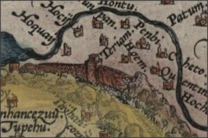
 Great wall
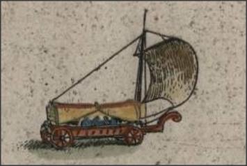
 Wind wagons
- Discussion in Van der Broecken’s scholarly website on the Theatrum http://www.orteliusmaps.com/book/ort164.html
- Van der Broecken, Marcel, Ortelius atlas maps : an illustrated guide, Houten: Hes & de Graaf, 2011, 491-493.
- Lach, Donald Frederick, Asia in the making of Europe, Chicago: University of Chicago Press, vol. 1.2, 1965, 818-19.
- Suárez, Thomas, Early mapping of Southeast Asia, Periplus, 1999, 170-171.
- CITCO 2003 May
- Needham, Joseph, Science and Civilization in China, Volume 4, Physics and Physical Technology, Part 2, Mechanical Engineering, Cambridge: Cambridge University Press, 1965, 274-281.
- http://en.wikipedia.org/wiki/Land_sailing


