Loading...
Home
About
About Rare & Special eZone
Terms of Use
Collections
Antique Maps of China
Ancient East Asian Maps
Maps of China, Late Qing Dynasty-1949
Rare Books on History of Science
Western books about China before 1949
James Lee Collection
Paul Lin and Soong Ching-ling Correspondence
Paul T. K. Lin’s Hsinhua Photo Collection
Sha Fei Photographic Collection
Chinese books before 1949 (Thread Bound)
Chinese books before 1949
HKUST Library Artwork
HKUST Posters
Walter R. Kent Collection
HKUST Electronic Theses
Results:
Modify search
region:Tianjin
x
Thumbnail
List
Sort By:
Relevance
Title
Year Ascending
Year Descending
Displaying results 1 - 3 of 3
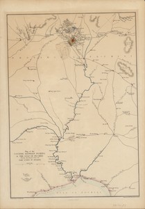
Map of the country between Pe-king &...
Tientsin = 天津
最新兩用天津市全圖
Map of the country between Pe-king & the gulf of Pe-chili : showing the advance from the Taku Forts to Pe-king
engraved by Edwd. Weller
MAP
Cassell, Petter, and Galpin , [1863].
1 online resource (1 map : hand colored)
Walter R. Kent Collection
Tientsin = 天津
Imperial Japanese Government Railways
MAP
Imperial Japanese Government Railways , [1915].
1 online resource (1 map : color)
Walter R. Kent Collection
最新兩用天津市全圖
MAP
復興輿地學社 , between 1945 and 1950
1 map : col. ; 59 x 33 cm., folded to 13 x 9 cm
Maps of China, Late Qing Dynasty-1949
Displaying results 1 - 3 of 3
Advanced Search
Expand all
Collapse all
Collection
(2)
Walter R. Kent Collection
(1)
Maps of China, Late Qing Dynasty-1949
Year published
(1)
1863
(1)
1915
(1)
1945
Language
(1)
Chinese
(1)
English
(1)
French
Geographic region
(3)
China
(3)
Tianjin
(1)
Beijing
(1)
Bo Hai
(1)
中國
(1)
天津
[More...]
[Less...]
Map maker
(1)
Japan
(1)
Weller, Edward, 1819-1884
(1)
復興輿地學社
Keyword
(1)
Railroads
(1)
Roads