Sort By:
Displaying results 1 - 7 of 7
-

A new mapp of y empire of China : with i...
-
A correct chart of the China Seas contai...
-
Les isles Philippines, celle de Formose,...
-
Partie de la Chine
-
The Philippine Islands
-
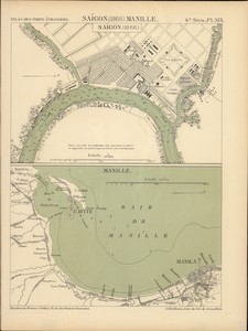
Saïgon (1866)
-

China Sea, Northern portion, Eastern she...
-
A new mapp of y empire of China : with its several provinces or kingdomes together w.th the adjacent Isles of Iapon or Niphon, Formosa, Hainan, etc
MAP
[publisher not identified] , 1682?
1 map : hand colored ; 29 x 38 cm
Antique Maps of China
-
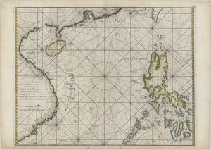
A correct chart of the China Seas containing the coasts of Tsiompa, Cochinchina, the Gulf of Tonquin, part of the coasts of China and the Philippin Islands
William Herbert
MAP
W. Herbert , 1767
1 map : hand col. ; 60 x 78 cm
Antique Maps of China
-
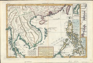
Les isles Philippines, celle de Formose, le sud de la Chine, les royaumes de Tunkin, de Cochinchine, de Camboge, de Siam, des Laos ; avec partie de ceux de Pegu et d'Ava
par M. Bonne ingeńieur-hydrographe de la marine ; André sculp
MAP
publisher not identified , 1783?
1 online resource (1 map : hand colored)
Walter R. Kent Collection
-
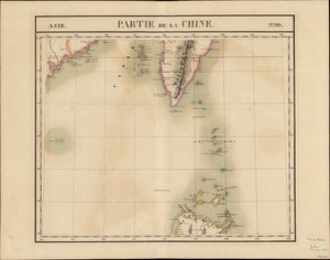
Partie de la Chine
Philippe Vandermaelen
MAP
Vandermaelen , 1827.
1 online resource (1 map : hand colored)
Walter R. Kent Collection
-
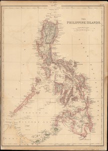
The Philippine Islands
engraved by Edwd. Weller
MAP
Schench & MacFarlane , 1860
1 online resource (1 map : color)
Walter R. Kent Collection
-
Saïgon (1866)
Ministère des Travaux Publics
MAP
Imprimerie Nationale , 1888.
1 online resource (2 maps on 1 sheet : color)
Walter R. Kent Collection
-
China Sea, Northern portion, Eastern sheet
BOOK
Hydrographic Office , 1967
1 map ; 96 x 64 cm
Nautical Chart
Displaying results 1 - 7 of 7

